Rebuild by Design Back to Portfolio
Integrating transportation, ecology, and development, the project transforms the Meadowlands basin to address a wide spectrum of risks while providing civic amenities and creating opportunities for new redevelopment. Link to Project Site

Combined Factor Map
ArcGIS / Adobe Illustrator / Adobe Photoshop
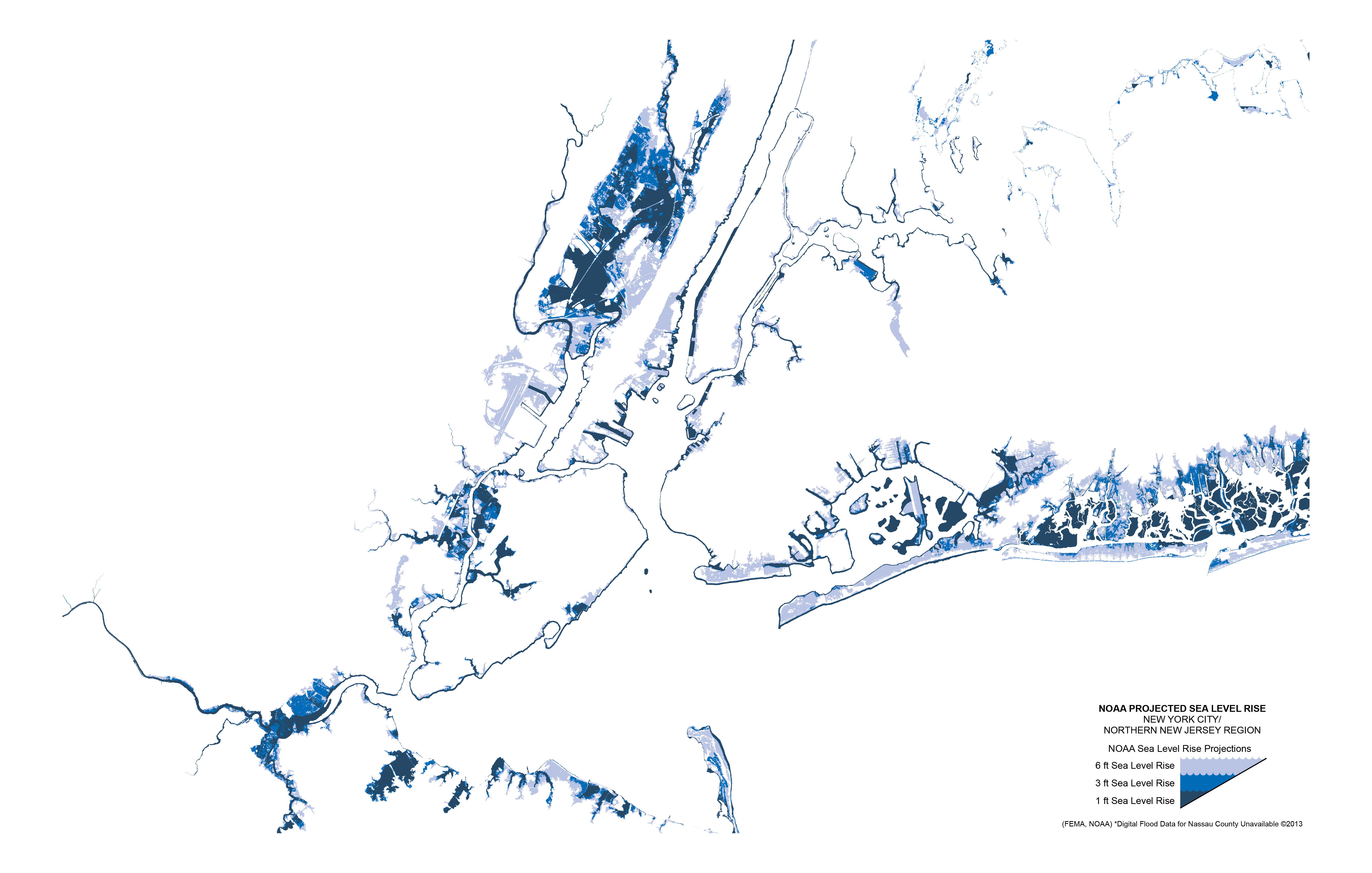
Flood Risk
ArcGIS / Adobe Illustrator / Adobe Photoshop
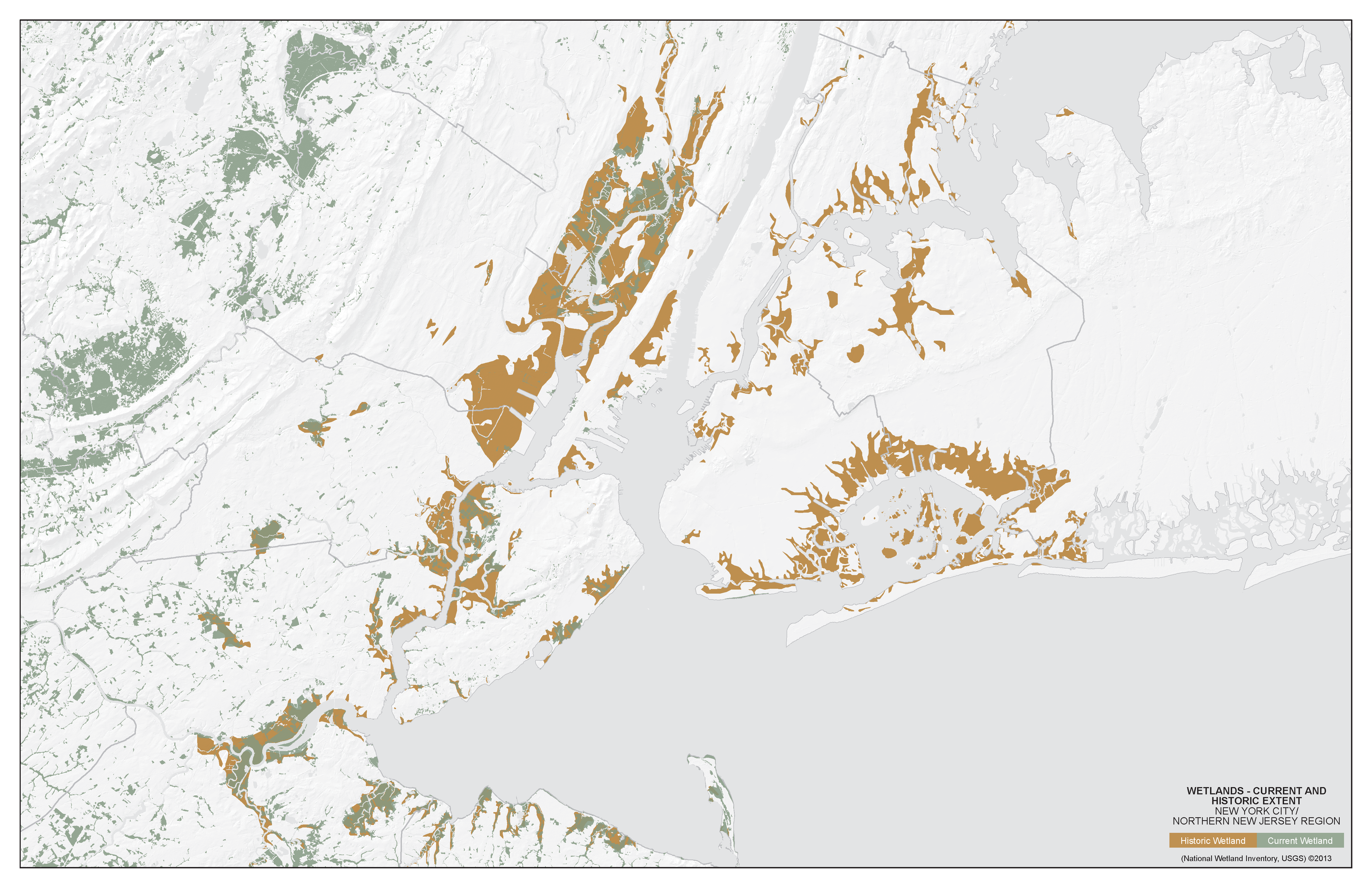
Historic Wetlands
ArcGIS / Adobe Illustrator / Adobe Photoshop
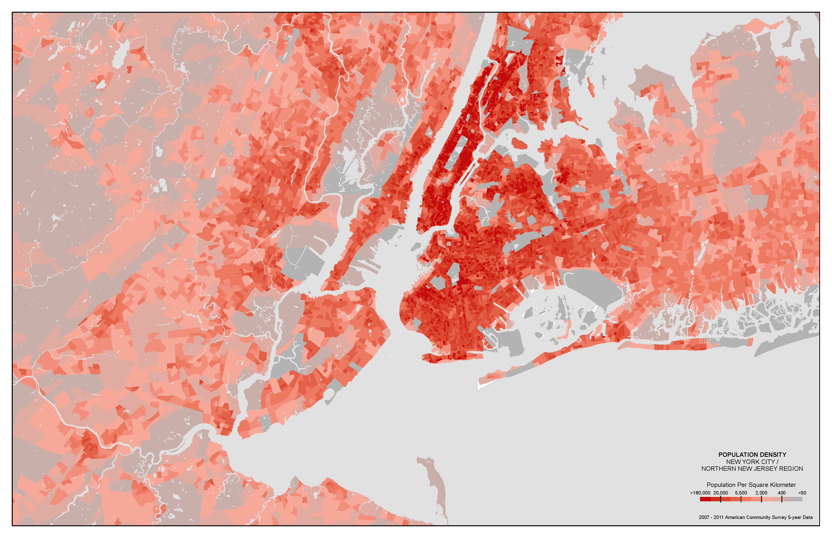
Population Density
ArcGIS / Adobe Illustrator / Adobe Photoshop
Transit Flow and Counts
ArcGIS / Adobe Illustrator / Adobe Photoshop
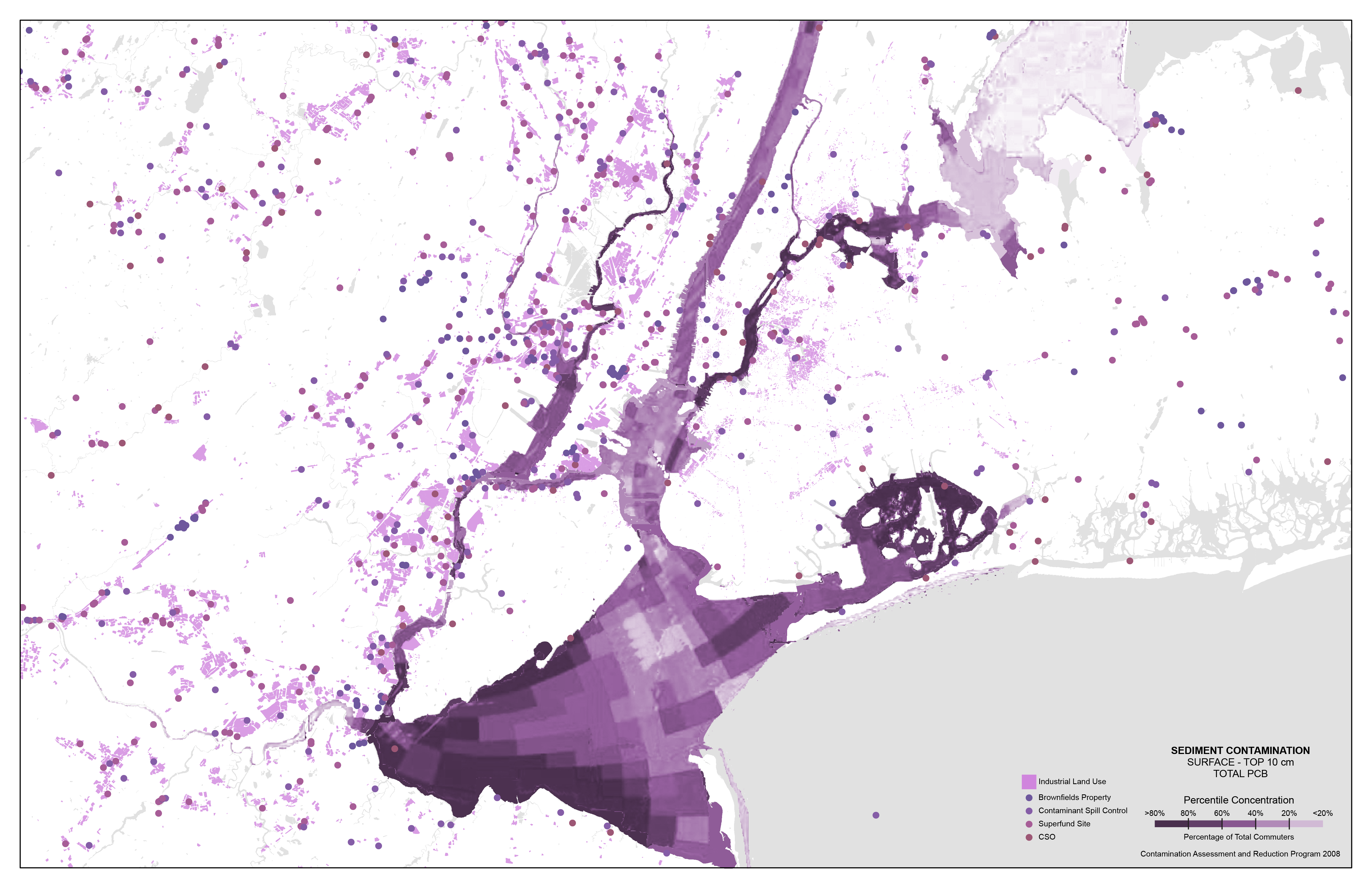
Water Pollution
ArcGIS / Adobe Illustrator / Adobe Photoshop